In this book, based on New Chronology, we show, that famous geographical "Atlases" of Ptolemy, allegedly of the II century A.D., and of Ortelius, allegedly of the XVI century A.D., show us geography of the Great = "Mongol" Empire of the XIV-XVII centuries. These are old maps of Russian Horde Empire.
FOR THE FIRST TIME IN RUSSIA we fully and with all details publish all the maps of famous "Geography" of Claudius Ptolemy in the edition of Sebastian Munster allegedly of 1540, and also all the maps of "Supplement to Ptolemy" allegedly of 1597, made by Cornelius van Wytfliet.
In the second chapter we FOR THE FIRST TIME IN RUSSIA publish a rare and exclusively interesting from the point of new chronology "Atlas" of Abraham Ortelius allegedly of 1590.
We know only one edition of the fragments from «Geography" of Ptolemy in Russian in a book: "Claudius Ptolemy. Manual on geography" in the series "Antique geography"; draftsman prof. M.S.Bodnarskiy, State publishing house of geographical literature, Moscow, 1953.
We want to remind, that astronomical dating of Almagest, which we received through mathematical methods, places it not in the II century A.D., as it is considered today, but to the Middle Ages. Moreover, editing of Almagest was continuing till the beginning of the XVII century A.D. See the book: V.V.Kalashnikov, G.V.Nosovskiy, A.T.FOMENKO, T.N.Fomenko. "Stars. (Astronomical methods in chronology. Ptolemy's Almagest. Ptolemy. Tycho Brahe. Copernicus. Egiptian zodiacs)". - Moscow, publishing house RIMIS, 2006.
As it was found, "Geography" of Ptolemy was also edited, most likely up to the XVII century.
We publish all the maps of Ptolemy in the most convenient form for study of valuable material, which they contain. This is an advantageous difference of our edition from most of the others. As a rule in albums, calendars, illustrated books etc. maps are published in a small format. Enlarged fragments, which let to read the inscriptions - the most valuable part of old maps, are usually not given. Old maps are presented just as pieces of art, which should be estimated with a "single look", as a painted picture.
That's why when publishing interesting maps of Ptolemy and Wytfliet we went another way. First we reproduce each map in full size on a separate sheet in order to give a possibility to see it whole. Than we divide a map on four similar size parts, - North-West, North-East, South-West, South-East and reproduce EACH OF THEM on a separate page. This increase is enough to see even small inscriptions and geographical details, which, as we show, contain important information. In some cases it drastically differs from the imposed "Scaligerian" view on geography of the Middle Ages. So, EACH MAP OF PTOLEMY AND WYTFLIET TAKES FIVE PAGES IN OUR EDITION.
COLORED ILLUSTRATIONS on two inserts of the book of A.T.Fomenko and G.V.Nosovskiy
OLD MAPS OF THE GREAT RUSSIAN EMPIRE.
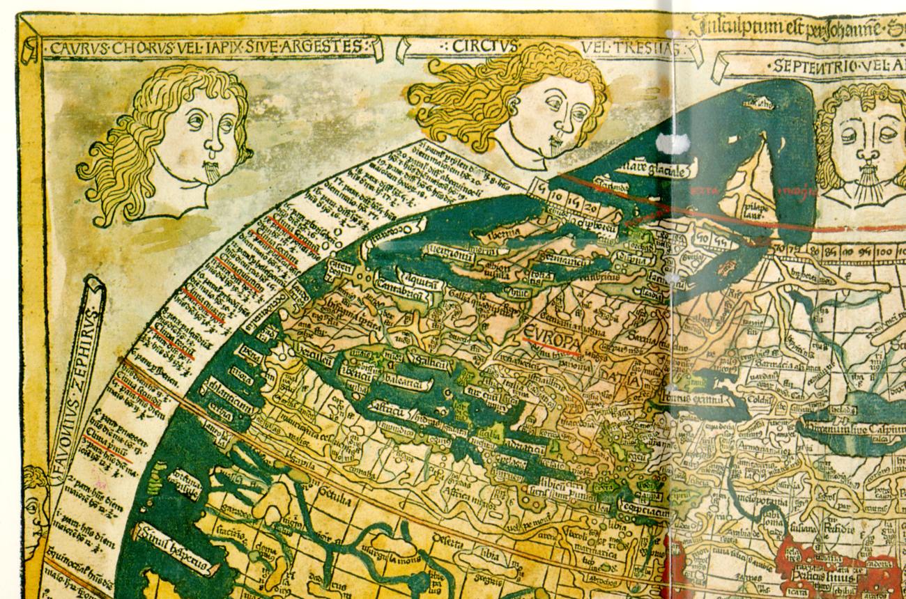
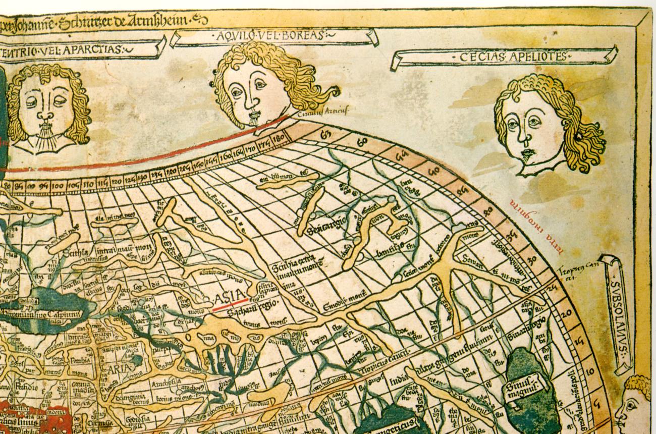
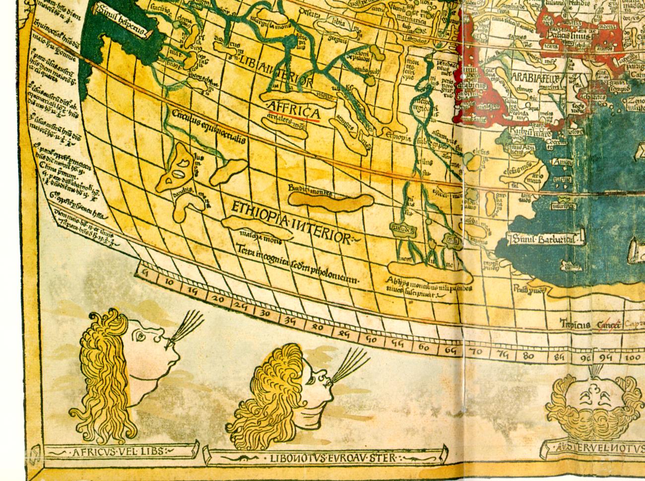
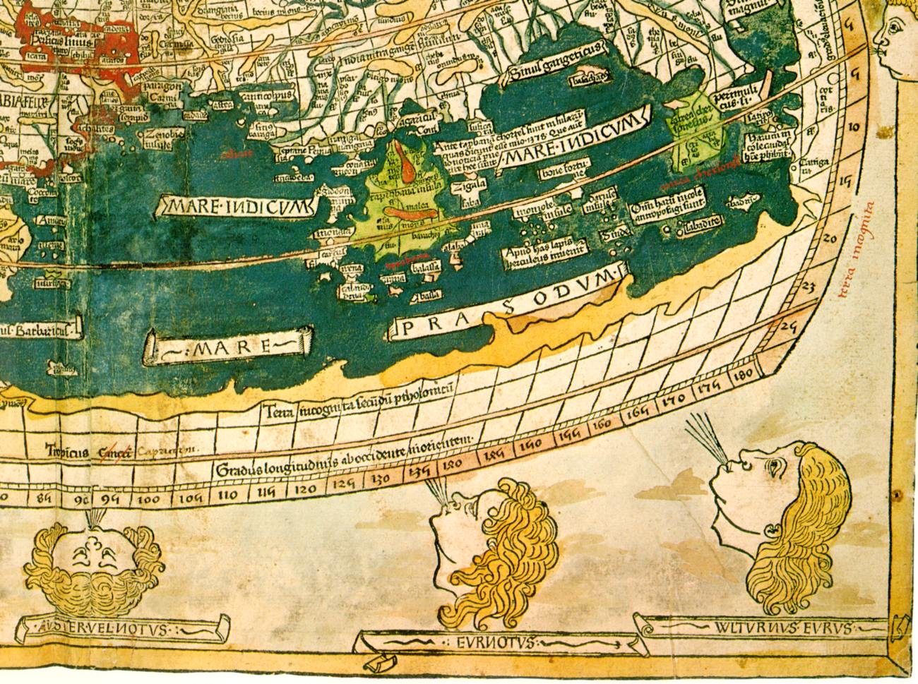
Map of the world, ascribed to Ptolemy. (Ulm, allegedly 1482). Taken from [1058], pp.12-13
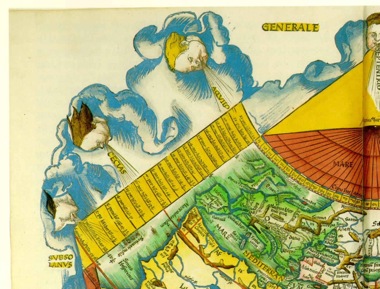
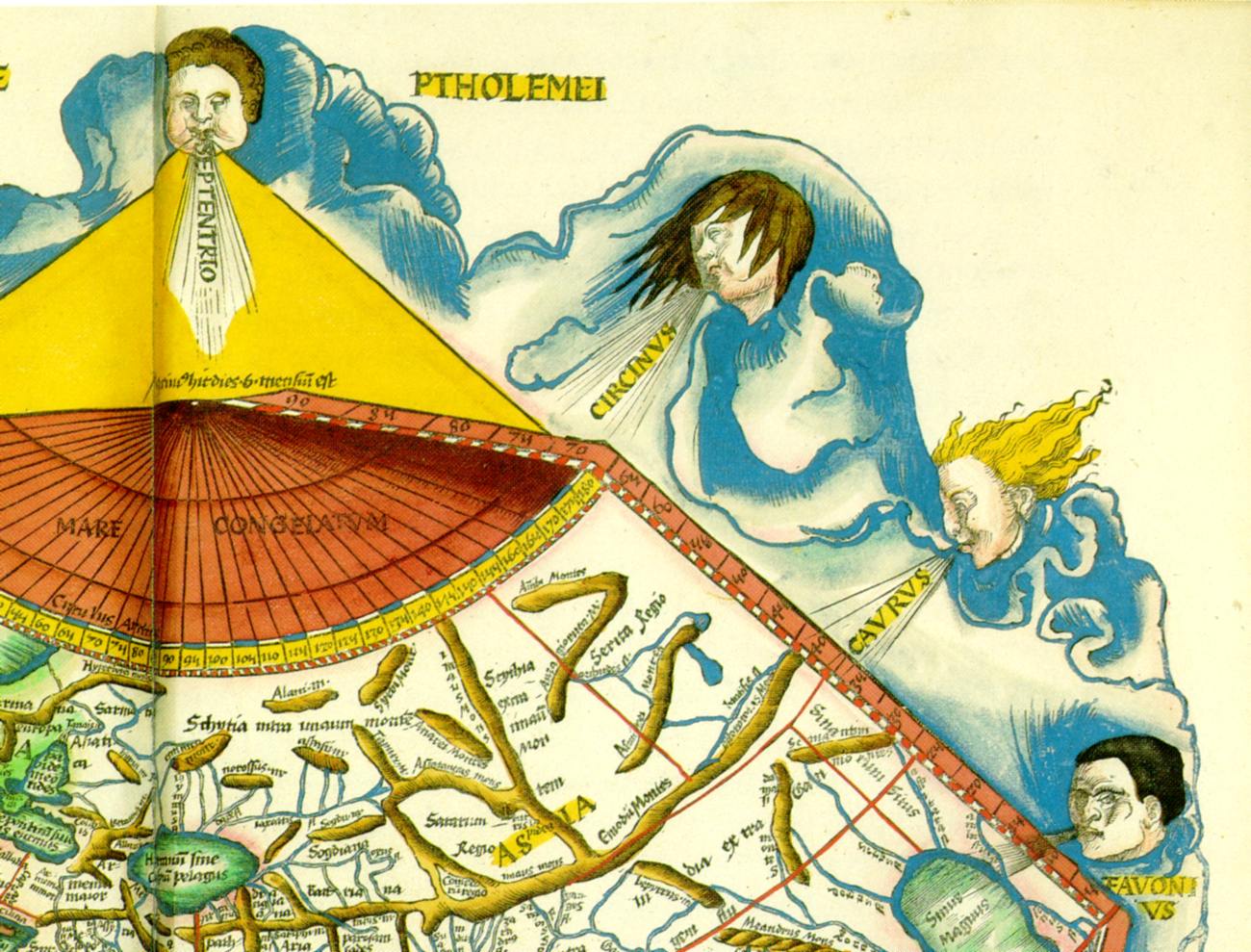
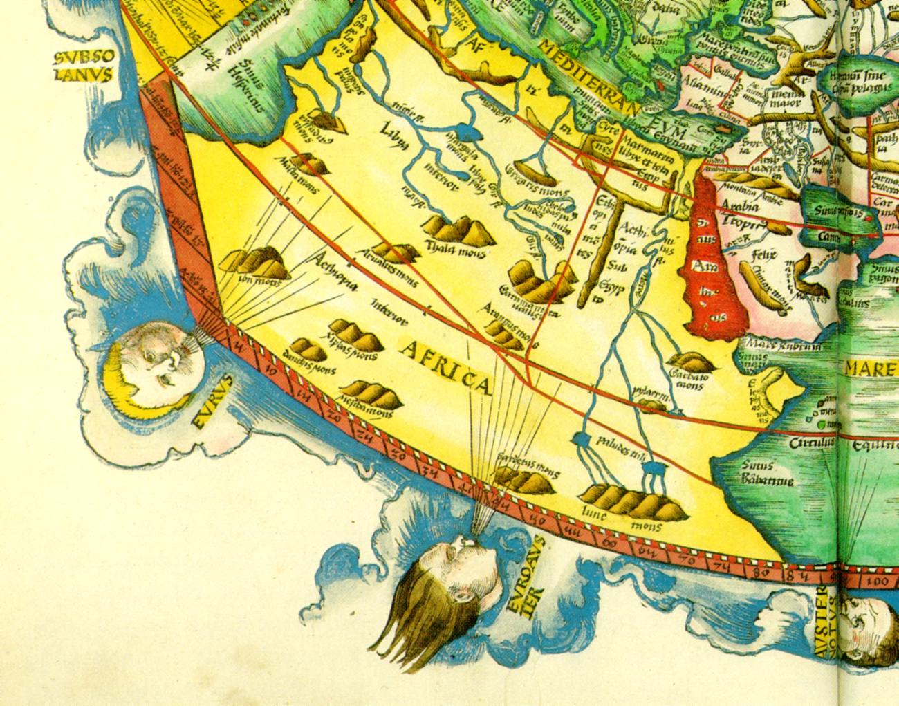
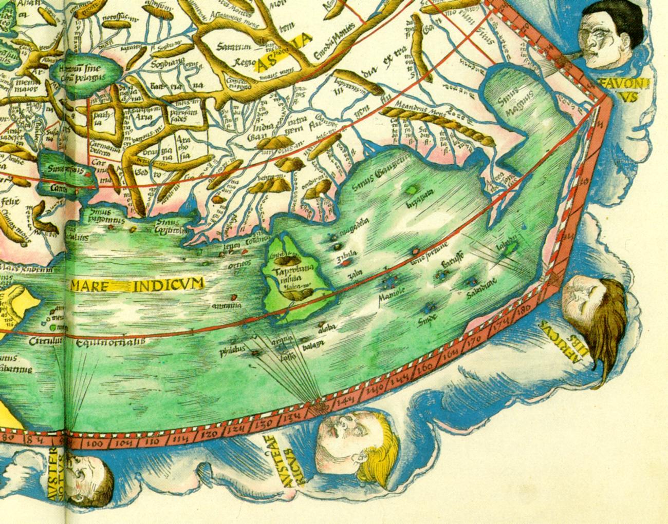
Map of the world, ascribed to Ptolemy. (Strasbourg, allegedly 1513). Taken from [1343], map 10
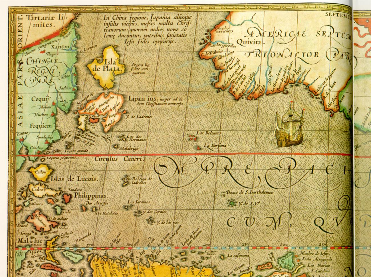
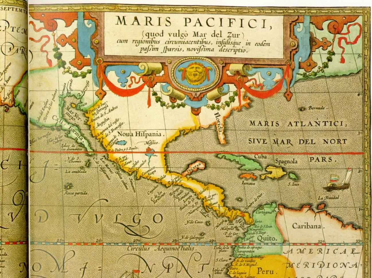
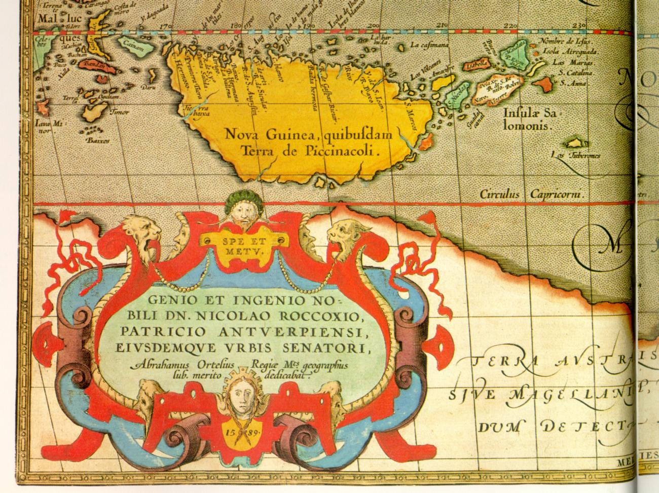
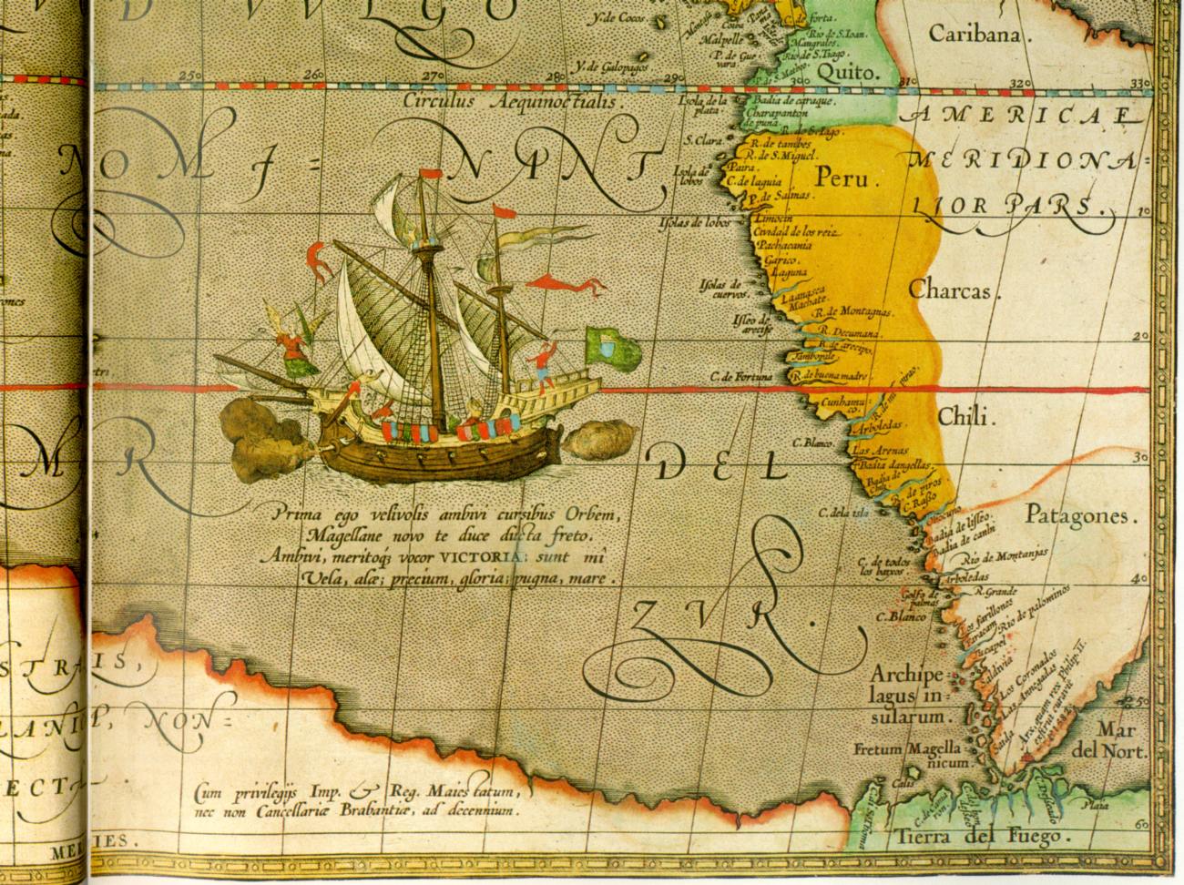
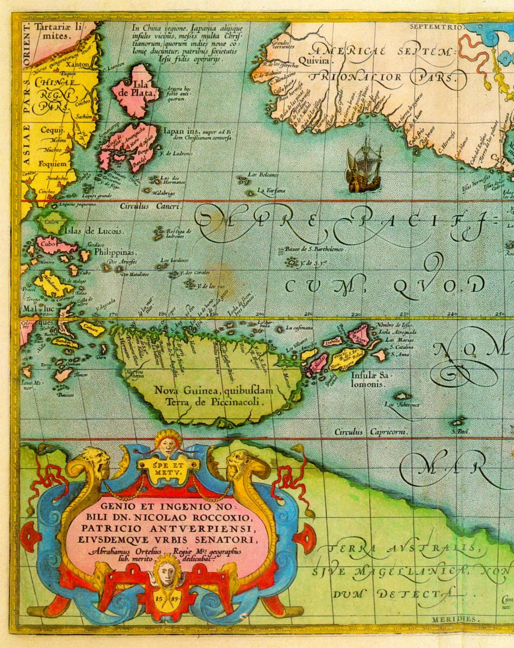
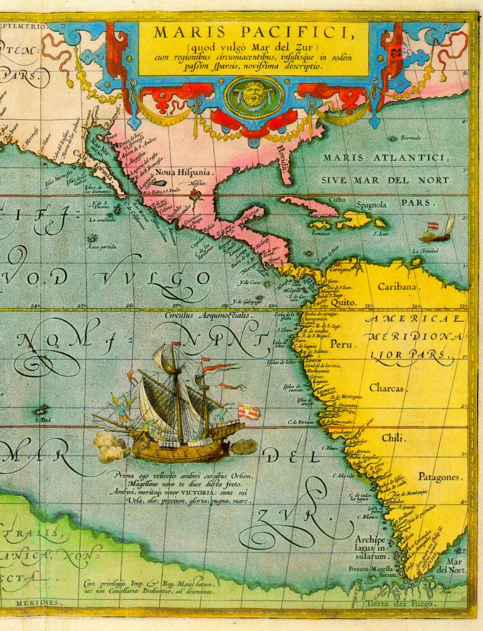
Map of the Pacific Ocean and America, ascribed to Ortelius. (Antwerp, allegedly 1589). Taken from [1058], pp.26-27, map 9.

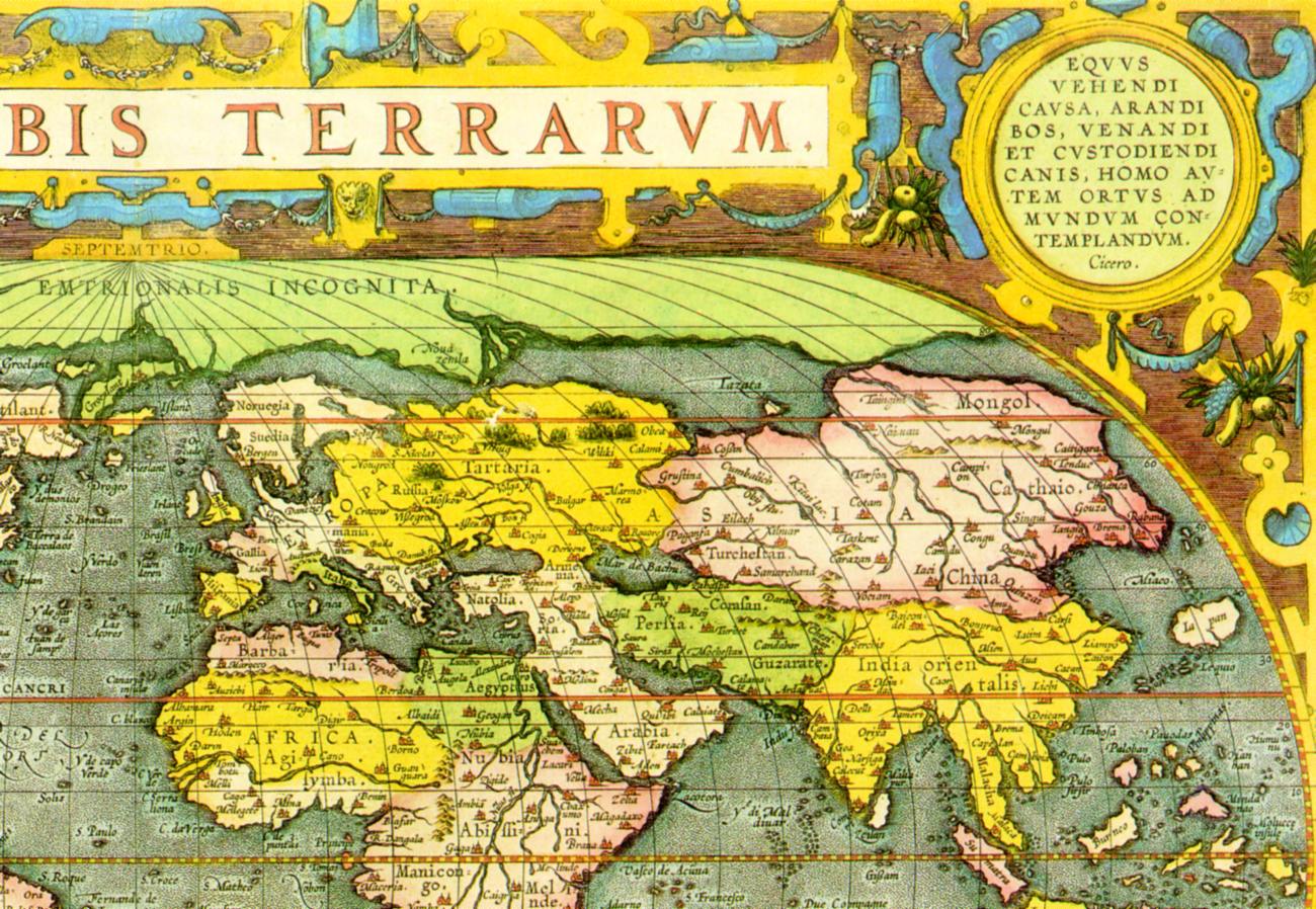
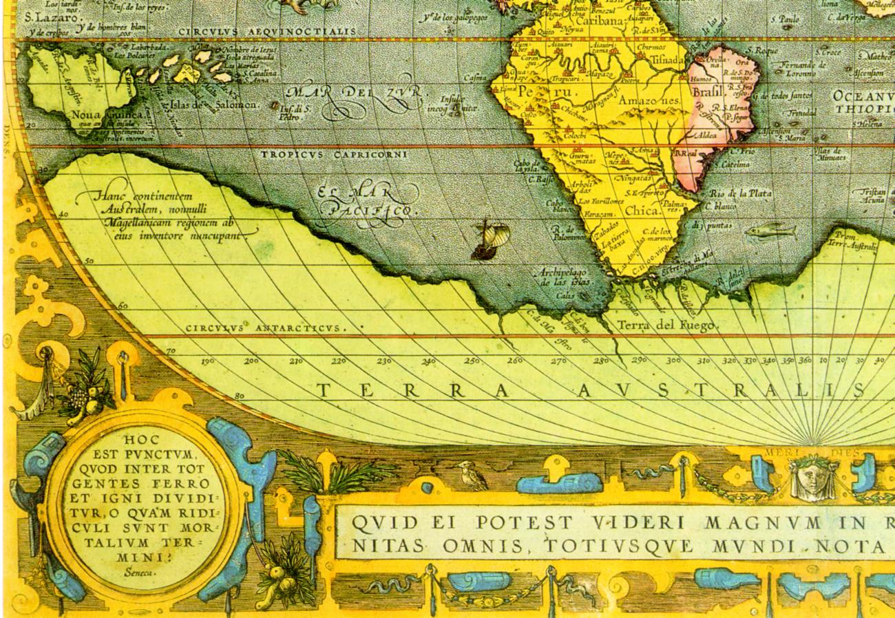
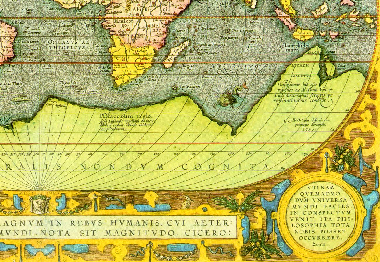
Map of the world, ascribed to Ortelius. Taken from [1009], p.81
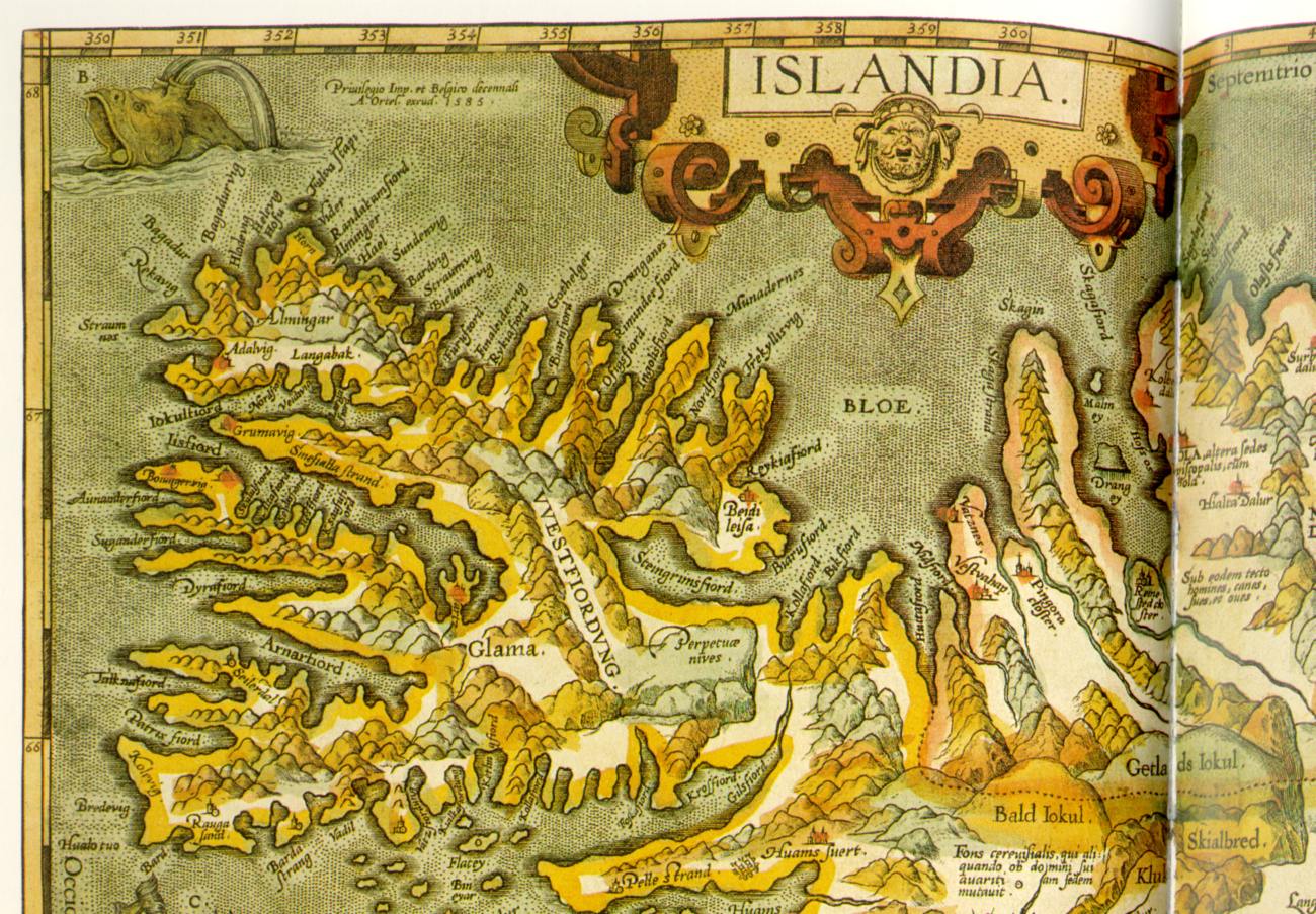
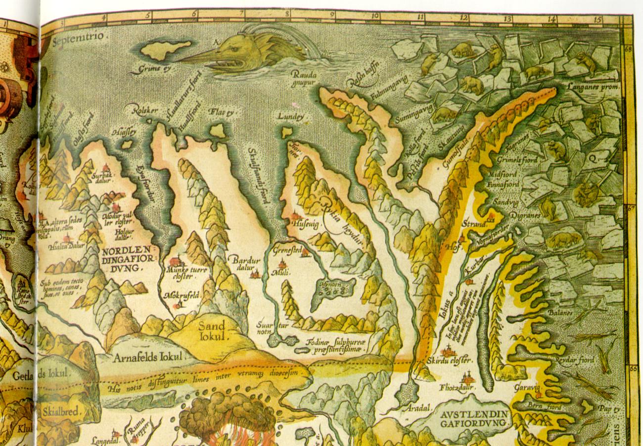
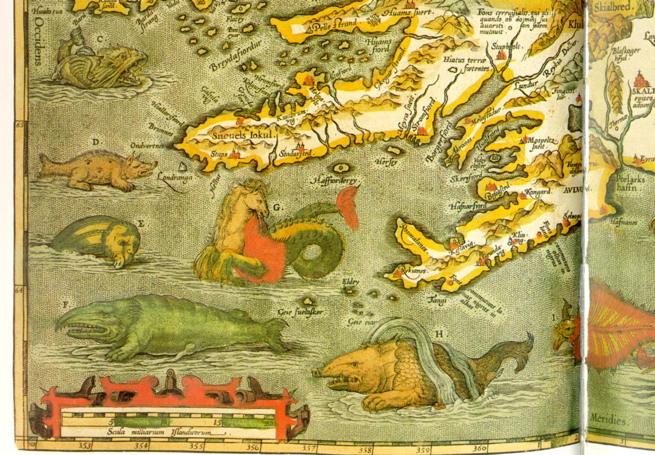
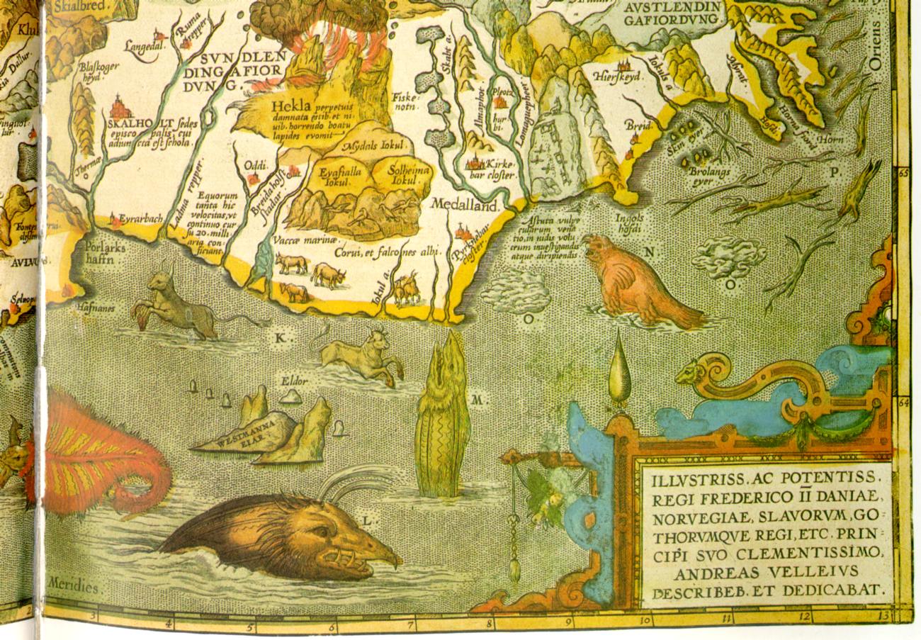
Map of Iceland ascribed to Ortelius. (Antwerp, allegedly 1585). Taken from [1058], pp.88-89, map 40.
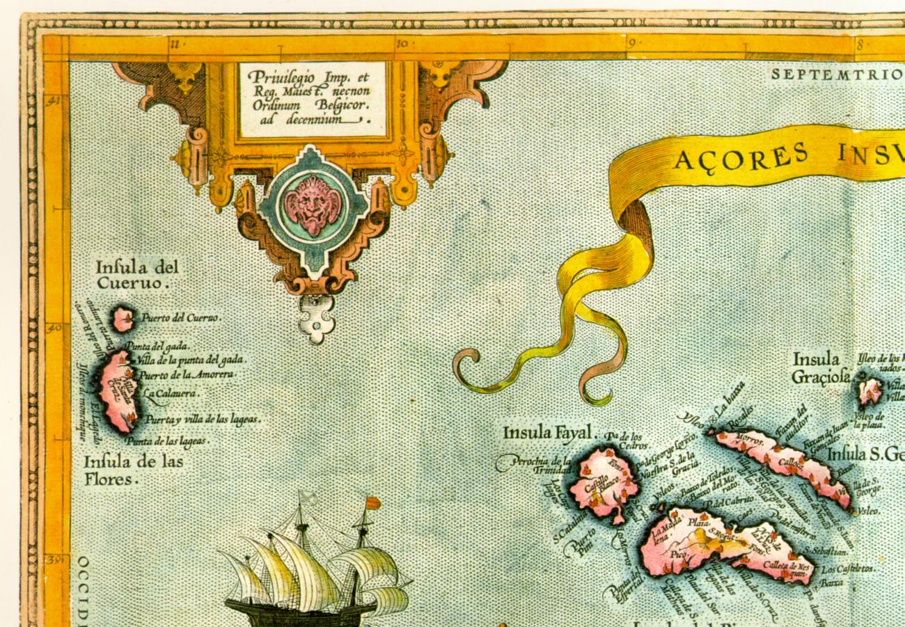
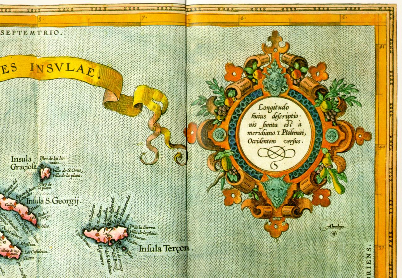
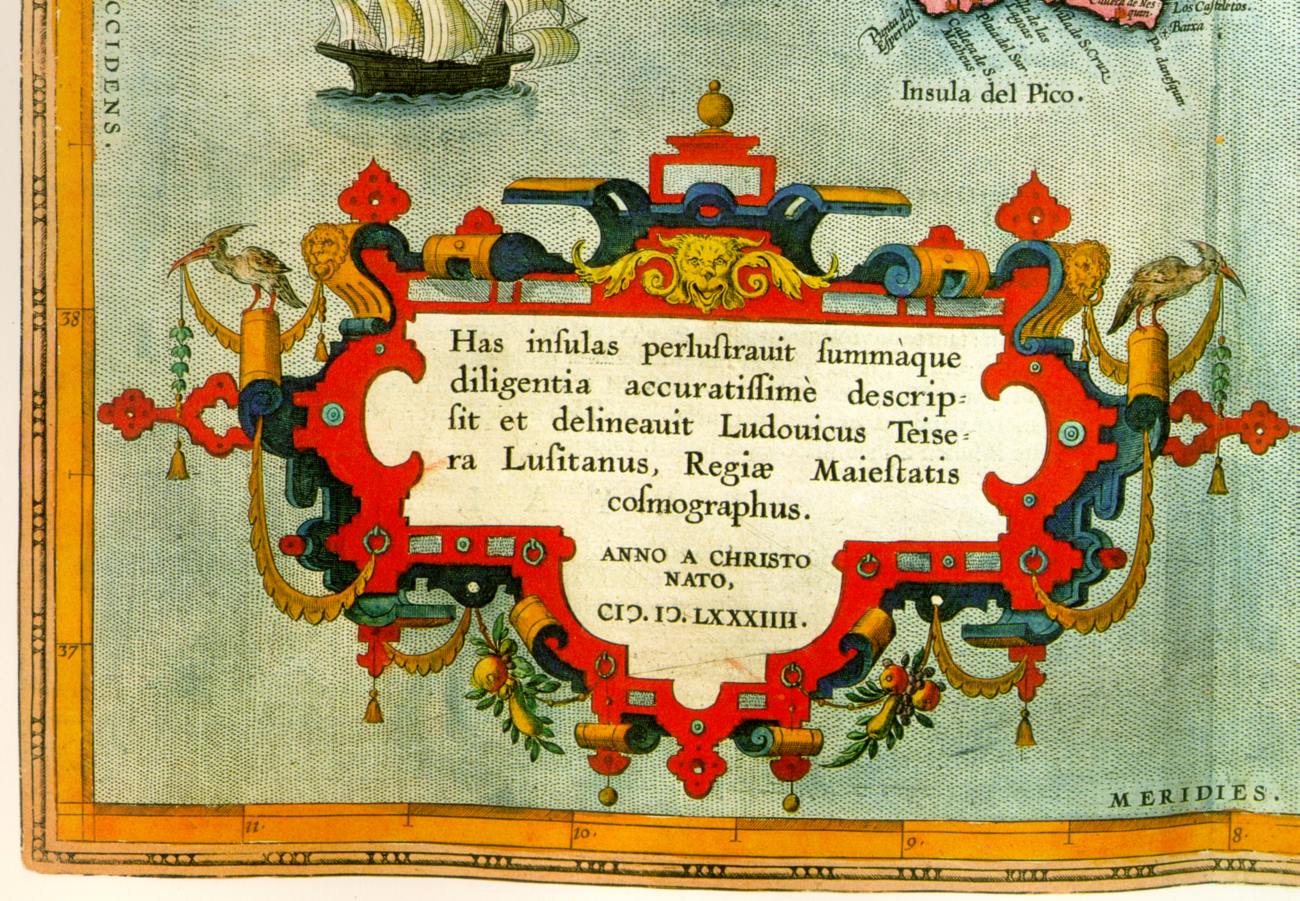
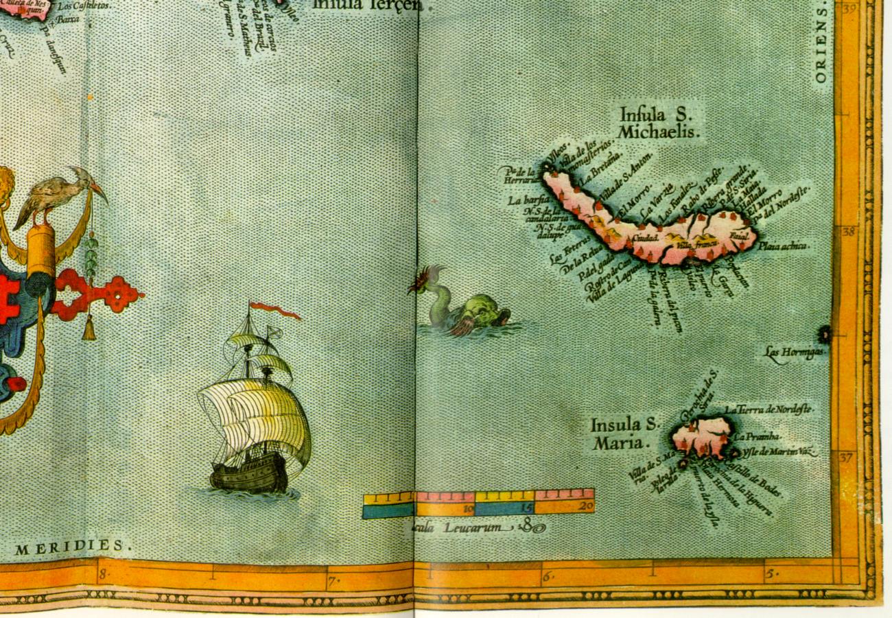
Map of the Azores ascribed to Ortelius. (Antwerp, allegedly 1584). Taken from [1058], pp.118-119, map 55.
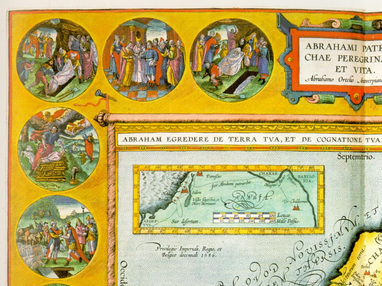
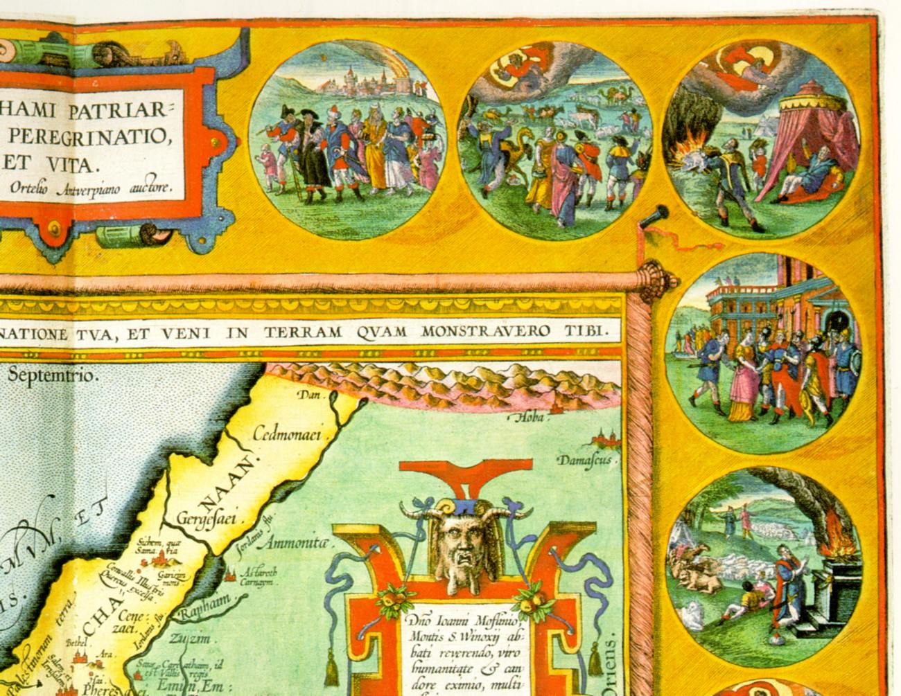
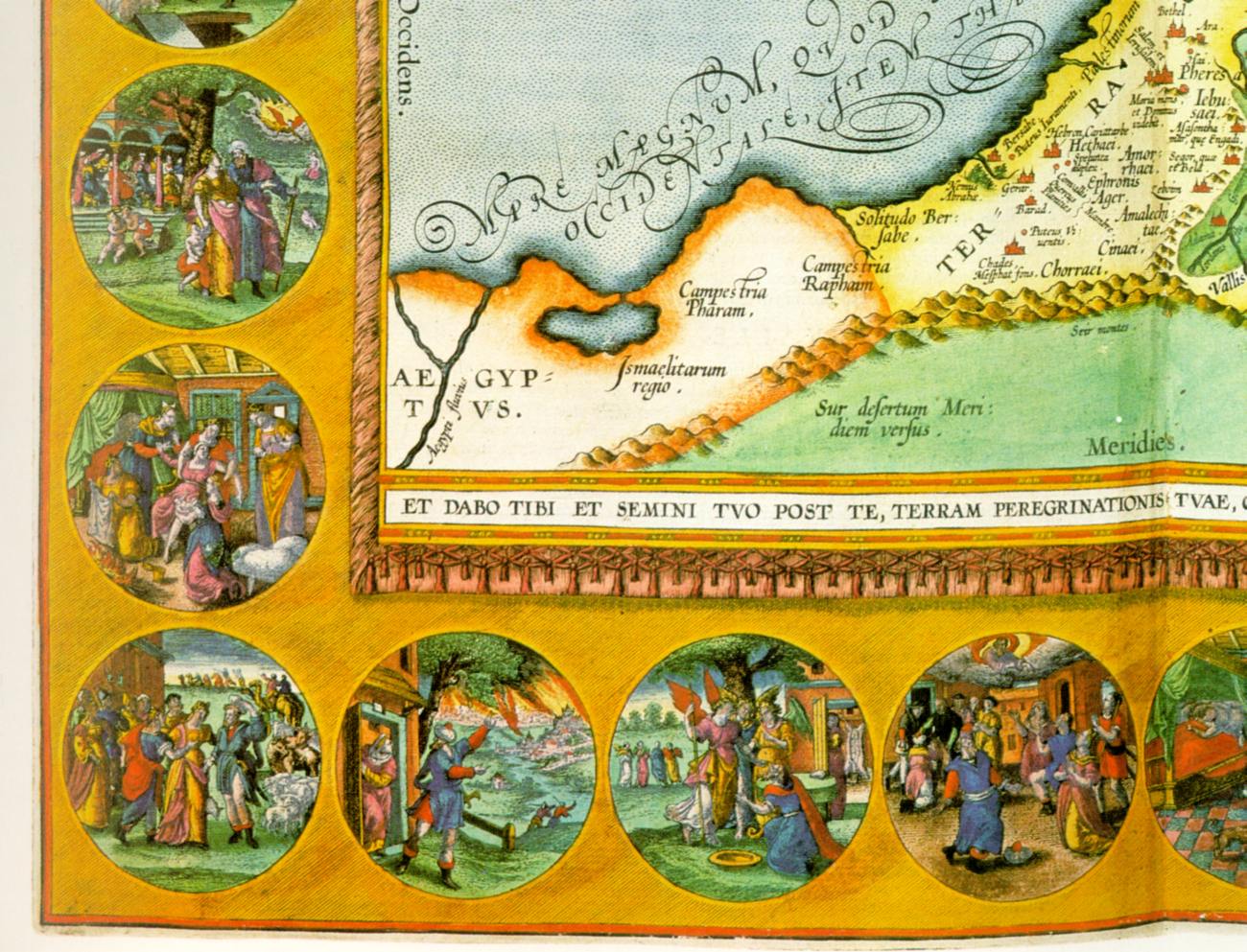
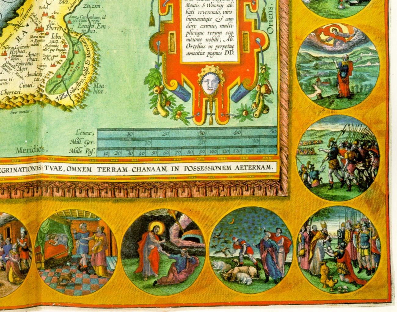
Map of Canaan, ascribed to Ortelius. In cartouches, placed around the map of Canaan the main episodes of the life of biblical patriarch Abraham. (Antwerp, allegedly 1586). Taken from [1058], p.125, map 58.

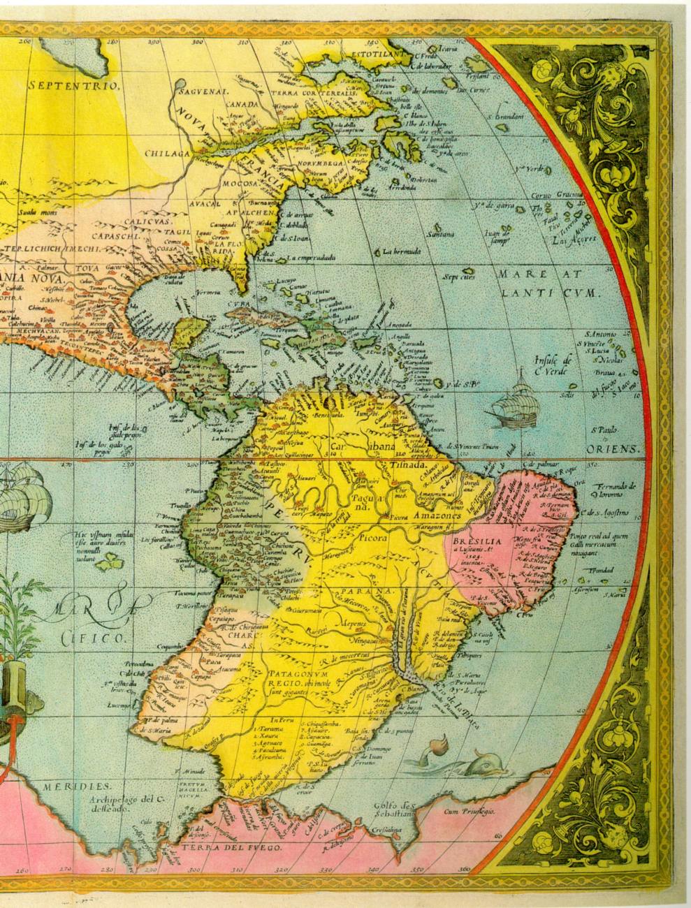
Map of America, ascribed to Ortelius. Allegedly 1575. Taken from [1009], p.92.
Another map of America, ascribed to Ortelius. Allegedly 1598. Taken from [1009], p.93.