MAPS OF SEMEN REMEZOV ARE VERY INTERESTING
 We place in our section Rare Sources an interesting atlas of Semen Remezov.
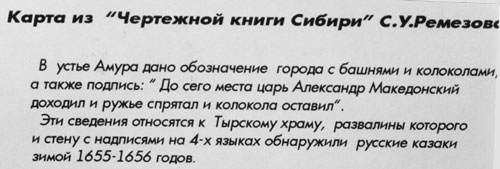
As a bright example we put here a photo of a plate, placed in a regional museum of city of Khabarovsk under an old map from the "Drafting book of Siberia" of S.U.Remezov, pic.11.65. The photo was kindly provided by G.A.Khrustalev:
pic.11.65
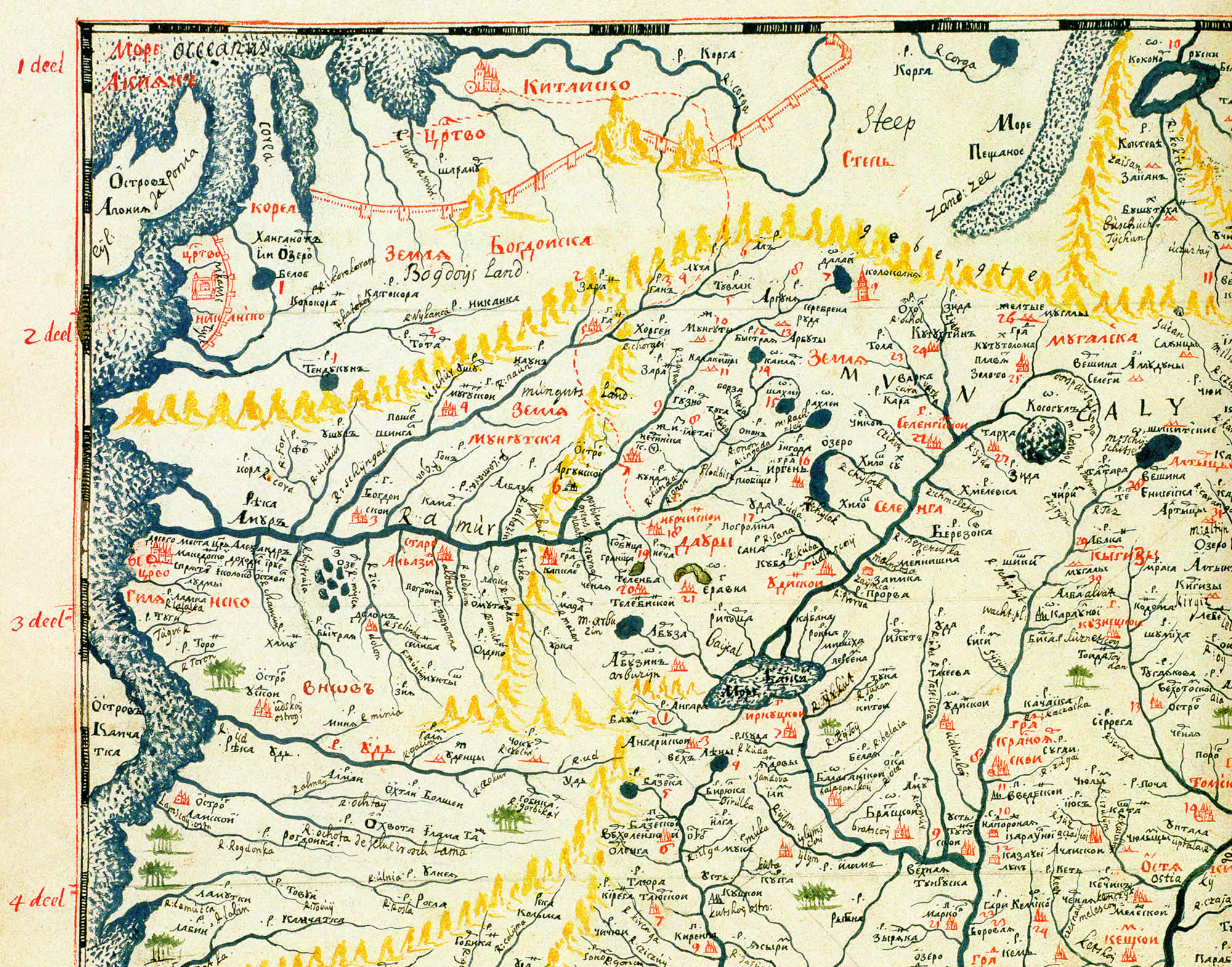
Semen Ulyanovich Remezov – a Russian map-maker and historian of the XVII century. His geographical atlas made of 23 maps «Drafting book of Siberia» is dated 1699-1701 [797], p.1114. A museum plate, pic.11.65, say, that on the map of S.U.Remezov <<in the creek of Amur there is an indication of a city with towers and bells and a signature: "TSAR ALEXANDER THE GREAT GOT TO THIS PLACE, HIDED THE GUNS AND LEFT THE BELLS">>. Seems, under "a gun" cannons and arms in general were meant.
Later we managed to find the map of Remezov itself in a good facsimile edition of his Atlas.
So looks the indicated sign on a map, pic.11.65a, pic.11.65b.
Zoom >>
Broadside with a map >>
pic. 11.65b .Zoomed marked fragment of the map with a signature:

From the modern point of view this old signature sounds wild. A campaign of "antique" Alexander the Great to the creek of far taiga Amur in the Scaligerian history is out of the question. Moreover with cannons and bells. Modern historian will graciously say: what to get from uneducated Remezov. He didn't know correct history. But how he could compose an excellent atlas of Siberia. However he «fantasized in a wrong way". It is not worth taking seriously his "historical fantasies".
But in our reconstruction the information, given by Remezov, is absolutely reasonable and believable. As tsar Alexander the Great (partly Suleyman the Glorious) lived in the XV-XVI centuries, at the epoch of great Osman-Ataman conquest, the waves of which reached the Far East, including China and Japan. As a result, in Japan appeared Samurai= Samarians=Samaritans. See the book "Biblical Russia".
As for the map, Remezov noted an interesting thing. This map (probably based on some early "Mongol" map) was hanged on the wall of Yekateringof palace in St. Petersburg. That's what a historian of the XIX century M.I.Pylyaev say. <<On the stairs, leading to the lower floor, on the wall instead of the wallpaper there is a big map of the Asian Russia on a canvas. THE MAP SEEMS TO BE DONE FOR JOKE: there are hardly any rivers in textbooks with such names, like here; the four winds also changed places on the map: at the top there are Indian and Sand seas, at the bottom there is North and Ice sea, Ocean (sic!), on the West there is Kamchatka and Hilyanian stardom on the bank of Amur, WITH A FUNNY SIGNATURE: "Alexander the Great got to this place, hided the guns and left the bells". According to legend, Peter for joke examined those, who were bad in geography with this map>> [711:1], p.82.
So at the time of Peter the map, which kept the traces of former geography and names of the Asian part of the Great = "Mongol" Empire, were still at the palace. But being already educated on a "new" Scaligerian-Miller history, Peter and his court treated the map as a joke. In the same way a historian of the XIX century M.I.Pylyev jokes about this map. Not suspecting, that most probably this map was more close to reality, than no long ago implemented into the minds Scaligerian geography. Today the map of Remezov "Big draft of all Siberia" is sometimes displayed in the Peter gallery of the State Hermitage in St. Petersburg [679], p.24.
Copies of the pages of the book of S.U. Remezov >>