47127, Там по Остии вопрос возник
Послано Астрахань, 29-04-2016 11:08
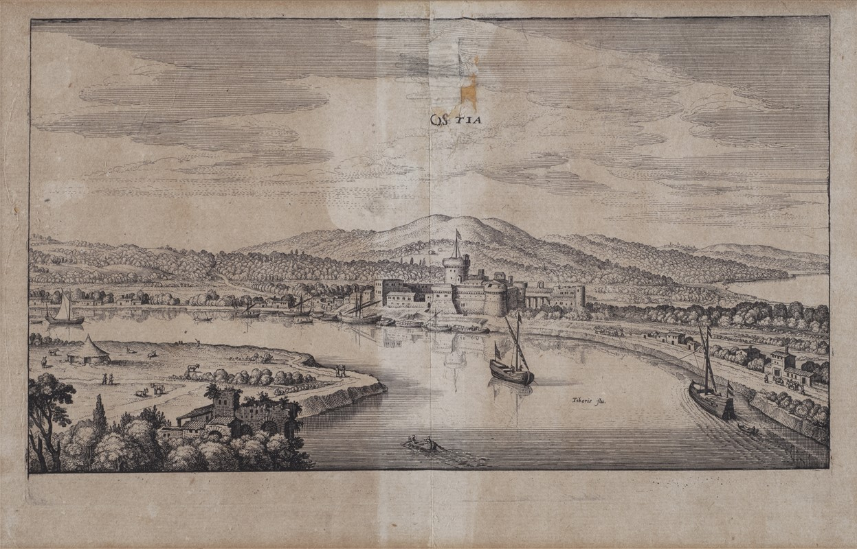
В описаниях этого древнеримского порта у традиков явно не сходятся концы с концами - вот гравюра Матиаса Мериана (1688 год):
Карта с изображением Остии 1547 года:
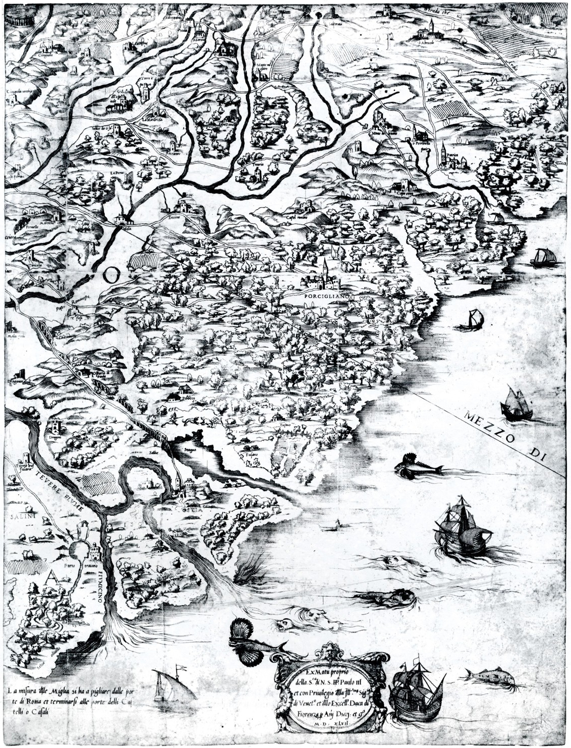
A map of the environs of Ostia by Eufrosino della Volpaia from 1547. Remains of the aqueduct can be seen in the upper part. Below is what seems to be an aqueduct, but is in reality the Via Ostiensis, raised and passing through swamps.
http://www.ostia-antica.org/past/volpaia.htm
А вот вид "античного Портуса", озаглавленный, как "Остия в Италии" и датированный семнадцатым веком!!!
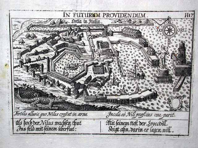
4.5 x 10 cm copperplate engraving, sheet size 18.5 x 15 cm, engraved circa 1623-1650, printed 1678.
A scarce engraving from the 1678 edition of the monumental town atlas of Daniel Meisner, published by Paulus Fürst in Nürnberg. First published as "Thesaurus Philo-politicus" in 1623 and later known as the "Sciographia Cosmica", this collection of city views from around the world continued to be published for more than 50 years after Meisner's death in 1625, eventually comprising 800 magnificent engravings. Rich in allegorical imagery, the Meisner engravings are masterful examples of Renaissance art and culture.
http://www.ostia-antica.org/past/meisner.htm
На переднем плане бегают крокодилы, картуш, на котором должно было быть описание этого порта почему-то пустой.
Вот Браун и Гогенберг - сверху написано, что это Остия, а считается, что нарисован Портус:
http://historic-cities.huji.ac.il/italy/ostia/maps/braun_hogenberg_IV_53.html
Походу этот Портус существовал в совсем другом месте...
|