|
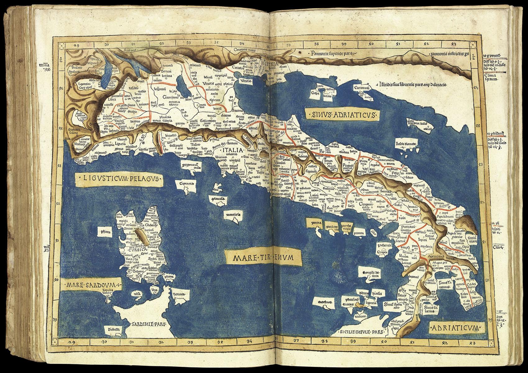
нашёл кусок карты из раннего Птолемея, где носок Италии соединён с Сицилией перешейком

отсюда
http://www.abebooks.co.uk/servlet/BookDetailsPL?bi=8571051528&searchurl=bsi%3D0%26amp%3Bds%3D30%26amp%3Bpics%3Don%26amp%3Bsortby%3D1%26amp%3Btn%3Dcosmographia
Cosmographia.
PTOLEMAEUS, Claudius
Published by Lienhart Holle, 16 July 1482., Ulm,, 1482
Description:
The first atlas illustrated with woodcut maps Royal folio atlas (414 by 297 mm), 140 leaves, double-column, 44 lines and headline, Gothic letter, 32 woodcut maps (all but one double-page),
The first atlas printed outside Italy and the first atlas illustrated with woodcut maps."The text is the early Latin translation by Jacopo d'Angelo, and its maps are the reworking of the Ptolemaic corpus by the cartographer Donnus (Dominus) Nicolaus Germanus. Three recensions of Nicolaus's reworkings have been distinguished: the first, drawn on a trapezoid projection reputedly devised by Nicolaus himself and, therefore, also known as the Donis (Donis = Dominus) projection; the second on a homeotheric projection and with three additional modern maps; and the third on the same projection with further revisions and two additional modern maps. The Ulm Ptolemy derives from the third recension, and thus represents Nicolaus's most mature work" (Campbell, 'Earliest Printed Maps', p. 124). The 1482 edition is the first printed edition to contain the full complement of 32 maps, and its world map, extended to the northwest, is the first printed cartographical representation of Greenland, Iceland and the North Atlantic.
слева 4 образца страниц
|
