Part 6.
Ancient Russia, world history and geography in mediaeval Scandinavian geographical tractates.
Chapter 21.
The meanings of the familiar modern geographical names in the Middle Ages. The opinion of the Scandinavians.
19. Perm and Bjarmaland.
Y. A. Melnikova dedicates several pages to the discussion about “the land of Bjarma” ([523], pages 197-200). The matter is that modern historians still cannot locate the country in question. Our reconstruction suggests an answer, qv in CHRON4, Chapter 14:20.3. Apparently, the ancient Bjarmaland, or the great Perm, can be identified as the part of the “Mongolian” Empire of the XIV-XVI century where one finds Germany, Austria and Italy today. Although the issue is more or less clear to us and has been discussed in CHRON4 already, let us nonetheless consider the undying debates of the historians about this country in order to illustrate the whole scale of contradictions introduced by the Scaligerian chronology into what might be regarded as a more or less clear picture.
Bjarmaland is believed to be a region in the north of the Eastern Europe. “It is often mentioned in different Scandinavian sources: royal sagas, sagas about the ancient times, chronicles etc” ([523], page 197).
Most modern historians locate Bjarmaland in the North of Russia or right nearby. According to the Scandinavian chronicles, “Bjarmaland is a wealthy country whose inhabitants possess great amounts of silver and precious jewellery. However, the Vikings don’t always succeed with the spoils – the natives of Bjarmaland are a militant nation, capable of defending themselves” ([523], page 198).
It is most curious how “K. Meinander tried to associate Bjarmaland with the region of Yaroslavl on the basis of archaeological findings” ([523], page 198). E. Kvalin claimed that Bjarmaland was located in the Volga Bulgary ([523], page 197). Others believed that a memory of Bjarmaland is still reflected in the name of Perm, a city in Russia ([523], page 200). However, Y. A. Melnikova instantly explains that these identifications are rejected by many modern historians ([523], page 200). We should hardly find this reaction surprising – indeed, Scaligerite believe Bjarmaland to be an ancient country – at any rate, “Bjarmaland and its inhabitants are mentioned in a great many sources starting from the late IX century A. D.” ([523], page 197). Perm is allegedly “a great deal younger”.
As a result, many historians of today prefer to consider Bjarmaland a mythical country and not a “real territory” ([523], page 200). According to Y. A. Melnikova, “it is possible that the accounts of voyages to Bjarmaland were embellished by details of a fantasy nature . . . and exaggerations” ([523], page 200).
Aren’t there too many mythical lands in Scaligerian history? We have the mysterious India, the kingdom of Presbyter Johannes, Serkland, Bjarmaland and many others . . . As soon as a mediaeval description of a given country begins to contradict the Scaligerian version, the country is instantly declared a fantasy, a myth and a fairy tale – something that never existed. This relieves the Scaligerites from the responsibility of answering a great many discomforting questions. A most convenient approach, isn’t it?
However, we are of the opinion that the majority of the so-called “mythical countries” can be identified as real countries of the XIV-XVI century, which failed to fit into Scaligerian mythology.
Since most scientists associate Bjarmaland with the ancient Russia in one way or another, could the name stand for “land of the boyars”? In the epoch of the Great Empire the boyars were a rich ruling class that existed in every province of the Empire, and not just its central part – including the modern territory of Germany, Austria and Italy, which our reconstruction identifies as the ancient Bjarmaland.
One must also remember that one of the royal attributes in the Horde was known as “barma” – a special kind of a precious necklace.
20. Polotsk. Paradise. Rostov.
According to the Scandinavians, the Russian city of Polotsk =*= Poltesk =*= Palteskja ([523], page 38).
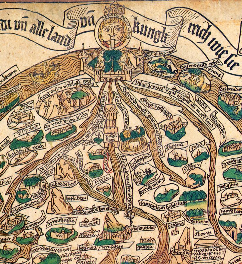
Moreover, according to the Scandinavians, paradise is located in the East (or, possibly in the Far East – see [523], page 32). Let us remind the reader that the Russian word for “paradise” is “rai”, and that the River Volga was known as “Ra” in many “ancient” sources. According to a popular mediaeval opinion, there were four rivers whose sources could be found in the oriental paradise – see, for instance, the mediaeval map of Hans Rüst dating from the end of the alleged XV century A. D., which we reproduce in its entirety in CHRON1, Chapter 5:11. We shall now reproduce the part that depicts the paradise in the east and the four rivers that have their sources there (fig. 21.2).
Thus, the mediaeval geographers used the term “paradise” for referring to some real geographical area. Which one? The highly arbitrary and abstract maps of the Middle Ages make this anything but an easy task. Yet it appears that we weren’t the first to note that there is a place where one finds the sources of the four largest rivers in Europe – the Volga, the Don, the Dnepr and the Western Dvina. It is the Central Russian Plateau. Volga is the largest – could this be the reason why it was called Ra? Many must have associated this area with the paradise as described in the Bible – these lands were indeed very appealing, and many dreamt of living here, at the very centre of the Empire.
Furthermore, Scandinavian maps indicate the whereabouts of Rostov, the famous Russian city (Radstofa in Scandinavian sources). According to the historians, its name is a derivative of two words: “council” (or “rada”) and “staff” ([523], page 44). This etymology is in perfect concurrence with our reconstruction. Rostov as the imperial capital (or a part thereof) can be associated with the imperial council as well as a staff, or sceptre – the symbol of royal power.
However, another hypothesis is also viable – Rostov = Ros + Tov, or “Russian Tobol” (Thubal), the latter being a part of the Great = “Mongolian” Empire.
21. Russia.
Scandinavian authors write a lot about Russia. Here are some of its names as used on maps and in geographical descriptions.
Russia =*= Gardariki =*= Rusia =*= Ruzkia =*= Ruzcia = Ruzaland ([523], page 226) =*= Risaland =*= Land of the Giants ([523], page 215) =*= Gardar ([523], page 46) =*= The Great City ([523], page 46) =*= Scythia = Great Svitjod.
Let us also add our identifications thereto:
Russia = Africa = Thracia = Turkey = Austrriki ([523], pages 87 and 89) = Austria.
As for the association of Russia with the land of the giants, this what Y. A. Melnikova tells us: “Ruzaland – the ancient Russia. A possible influence of the toponym Risaland – ‘land of the giants’” ([523], page 215).
The matter is that the Scandinavian words used for referring to the giants were “riza” and “rizar” ([523], page 178).
<<The toponym Gadar might reflect some of the ancient Russian names stemming from the root ‘gorod’ or ‘grad’ (“city” or “town”) – Gorodets, Goroden, Gorodok etc (there is over a dozen of those in existence). Some of them had composite names for more precise definitions – such as “Gorodets Radilov” (on the Volga), “Gorodets Vostrskiy” (on River Ostra) and so on. Some places with similar names existed in the North-East of Russia (two towns with names featuring the root “Gorodok” near Byeloye Ozero (White Lake)), as well as the Northwest – Gorodets on River Neman and Vyshgorod in Shelon>> ([523], page 38).
And so, according to Y. A. Melnikova, the name “Gardariki” translated as “Land of the Cities”. Let us also point out that the word in question might be interpreted as “Orda-Riki”, or “Kingdom of the Horde” (cf. the Russian for “fence”, or “ograda”, and also the English word “guard”).
Furthermore, Scandinavian geographical tractates report the following:
Russia =*= The Great Svitjod = Godland =*= the land of gods =*= Gothland =*= Gothia (land of the Goths) – see [523], pages 98-99.
The geographical identification of Russia and Gothia as the same territory, which we encounter in Scandinavian chronicles, is of the greatest interest to us. Let us linger on it for a longer while. Y. A. Melnikova reports: “In some works the rendition of the legend about Scandinavia populated by the natives of Asia, which is where the Aesir had lived before they migrated to Scandinavia, uses the term ‘Godland’, or ‘Land of the Gods”. Similarly: ‘They call this very Svitjod Mannheim, or ‘the dwelling of humans’ (from ‘madr’ – human), whereas the Great Svitjod is called ‘Godheim’ . . . The identification of the homeland of the Aesir as the Great Svitjod, or Scythia, contradicts the ‘Trojan’ theory of their origin” ([523], page 98).
As we demonstrated in CHRON5, Chapter 3, there is no contradiction here in reality. The Scandinavian “Trojan theory” is correct, and only considered erroneous by the modern historians due to the influence of the erroneous Scaligerian chronology.
Melnikova continues: “Yet one gets the idea that this contradiction wasn’t perceived as such by the Scandinavians themselves due to their rather perfunctory knowledge of the territories quite as distant” ([523], page 98). “Wasn’t perceived”, no less – most probably, because the Scandinavians were familiar with the territories in question quite well. Once again, historians are forced to hint at the “ignorance” of the Scandinavians.
Further on, the Scandinavian chronicle tells us the following: “The lands populated by the natives of Asia were called Godland, whereas the nation itself was known as Godiod” ([523], page 95). The Scandinavian identification of Scythia = Great Svitjod as Godland, or the Land of Gods (alternatively, “Land of the Great God”), likewise the association with the land of the Goths (gods) is rather difficult to digest for the modern historian.
Y. A. Melnikova writes: “This very identification may have been based on the vague information about the migration of the Goths to the north of the Black Sea region in the beginning of the new era [one sees how the authors are constantly confounded by the erroneous Scaligerian chronology – Auth.] The different variants of spelling the ethnicon Godiod . . . such as Cottiod, Gauta Tiod, Gotu-Tioda etc also imply close ties with the ethnicon ‘gotar’, or ‘gautar’ – ‘Goths’” ([523], pages 98 and 99).
Let us also point out that the term Gotland as applied to Russia (translated as “Land of the Gods” by Y. A. Melnikova) reflects the name “God’s land”, which was actually used in the Middle Ages for referring to Russia. This waters down the pathos of the translation, making it easier to comprehend – it was a reference to the Orthodox Russia, which had spread the Christian faith all across the world – the belief in Jesus Christ, or “the great god”.
One must applaud the skill of Y. A. Melnikova, who often suggests correct interpretations of many Scandinavian identifications that she has discovered in spite of the Scaligerian dates that constantly get in her way. Still she obviously attempts to steer clear of “dangerous corollaries”.
Let us quote another comment of hers: “Similarly to the legend of the Asian homeland of the Scandinavians, the author of the tractate tried to place the history of the Scandinavian nations into a global context” ([523], page 99). This remark, as well as many similar passages of the modern commentators, appears to question the veracity of such claims made by the ancient Scandinavians. We are of the opinion that the mediaeval Scandinavians didn’t invent anything, but rather told the truth for the most part.
22. Saxland. Lesser Svitjod. Northern Dvina.
According to the Scandinavians, the word Saxland =*= Germany ([523], page 34).
Furthermore, the Scandinavian Svitjod (or “Lesser Svitjod”) =*= Sweden ([523], pages 136 and 138).
The modern name of Sweden is obviously related to the mediaeval toponym Svitjod, or the word “holy” (as applied to Russia), as we have seen above. Apparently, Lesser Svitjod was regarded as the country populated by the natives of the Greater Svitjod, qv above.
Furthermore: Northern Dvina =*= Vina ([523], page 5).
23. Serkland.
Scandinavians suggest the following geographical identifications:
Serkland =*= Land of the Seres =*= Saracenarnasland, or land of the Saracenes =*= Chaldaea (!) =*= Africa =*= Palestine =*= Mesopotamia = China.
Let us reiterate that all the identifications listed above are Scandinavian.
23.1. Is it correct that the land of the Seres, or Serkland, can be identified as the modern China?
This is what Y. A. Melnikova has to say in this respect: “Seres, Serir and Serki – the ethnicon is most likely to stem from the Chinese word for ‘silk’ according to most researchers” ([523], page 215).
Let us also add that the very word Seres may have come to the modern China from Russia and Europe – first as the name of the nation that came to China, and later as the name of silk – a product brought to China from Byzantium, for instance.
We should also pay attention to the following passage: “Initially, it [the name ‘Seres’ – Auth.] apparently referred to the sellers of silk and not the Chinese themselves” ([523], page 215). Everything is perfectly correct – the Seres must be the nation that initially supplied the Chinese with silk. The Byzantines, perhaps? Later on, the manufacture of silk was mastered by the Chinese as well.
<<Ancient geographers refer to the city of Sera (or Seres) and the nation of the Seres [the Russians? – Auth.], which they locate somewhere alongside the Great Silk Road, but the exact location remains in need of greater precision – somewhere beyond Bactria in the direction of the “Eastern Ocean”, between the Scythians and the Indians>> ([523], page 215). In general, it turns out that ever since the “antiquity”, reports concerning the nation of the Seres, likewise the city of Sera (or Seres) “happen to be common for many mediaeval authors” ([523], page 149).
Our hypothesis is as follows: the Seres can be identified as the Russians (with their name read in reverse).
23.2. Silk and combed plants: anything in common?
Further on, the Scandinavian author tells us: “This land [Seres – Auth.] is abundant with amazing leaves, which can be combed just like the wool of the sheep, and then sold abroad for the manufacture of clothing” ([523], page 146).
Y. A. Melnikova also quotes the following remarkable mediaeval passage: “Seres – a city in the east, which gave its name to the land and the people. The land of Seres forms a crescent starting from the Scythian Ocean and the Caspian Sea and stretched towards the Eastern Ocean; it is famous because of the leaves that serve as a source of thread” ([523], pages 215 and 216).
Modern historians are certain that the thread in question can be identified as silk. Our opponents might counter our hypothesis about the Seres identified as the Russians reminding us that there are no mulberry trees anywhere in the central part of the “Mongolian” Empire, and no silk was ever made there. And yet there is no contradiction here. Firstly, the Great Empire of the XIV-XVI century was so enormous that it naturally included areas which manufactured silk. In CHRON5, Chapter 12:4.3, we already pointed out that for a long time the Russian and Ottoman markets remained the only source of silk for the Europeans. Therefore, it is hardly surprising that some West European texts should refer to the land of the Seres, or the Russians, as to the home of the silk manufacturers.
Secondly, who said that the word “seres” referred to silk initially? After all, we have witnessed how many names were changing their meaning with the course of time. Let us once again consider the mediaeval Scandinavian reports concerning the tread from the “land of the Seres”. The Scandinavians tell us about “combed leaves” – hardly applicable to silk, since it is spun and not “combed” – from silkworm cocoons and not any actual plants, to be more precise.
Let us enquire about the plant that can be combed into a thread, or has thread growing on it. The answer is self-implied – cotton or linen. Therefore, let us voice the following natural consideration: initially, the word “seres” referred to cotton or linen. The manufacture of cotton, let alone linen, was commonplace all across the Great = “Mongolian” Empire. It was only much later that the word “seres” started to translate as “silk”.
However, the Europeans retained the memory about “seres” being “thread gathered from leaves by combing” for a long time – linen or cotton, after all! Also, this is what we learn from Y. A. Melnikova: “Although the Europeans became acquainted with silkworms in the early Middle Ages [according to our version, it only happened in the XIV-XV century – Auth.], this passage remains in many encyclopaedias” ([523], page 149). That is to say, despite having been familiar with silk for a long time, the Europeans still refused to understand its real nature.
23.3. Serkland as the land of the Saracenes.
Let us return to the analysis of Serkland. It turns out that the name “was used in XIII-XIV century sources almost exclusively for referring to the population of the Muslim countries, or the ‘Saracenes’. . . In geographical tractates the term applies to the lands with a Muslim population, which makes it synonymous to the toponym Saracenarnasland – ‘land of the Saracens’”.
Melnikova continues as follows: <<No rigid localization of said term happens to be in existence, though. Different sources locate it in Africa or in Asia. The tractate ‘Countries of the World’ identifies Serkland as Palestine. Two other tractates suggest Chaldea and Mesopotamia as likely identifications of Serkland. “Descriptions of the World” I and II are convinced that its real location is in the north of Africa; the latter, which is extremely convoluted and contains numerous errata [as seen by the modern commentator – Auth.] locates Serkland the Great (Serkland it mikla) as follows:
a) In North Africa.
b) Also in Africa, but closer to the Scythian border [sic! – Auth.], identified as Great Svitjod. ‘Descriptions of the World III’ lists Serkland among the African countries, but several lines later identifies it as Chaldaea [sic! – Auth.], universally recognized as an Asian country>> ([523], page 216).
The obvious implication is that during certain historical periods “Africa” was a name used for referring to Asia, or some part of Europe. Most likely, as we have mentioned earlier, European Africa is simply a corrupted version of the name Thracia = Tartary, later Turkey.
Of course, modern commentators, who have grown accustomed to the belief that the name Africa always referred to the same territory – namely, the modern African continent, are forced to believe that the name “Serkland” was a “vagabond name” in the Middle Ages. However, in this case, why doesn’t one assume that Africa was a “vagabond name” as well? This is precisely what we claim – geographical names on the ancient maps were in a constant state of flux.
Y. A. Melnikova tells us further: “Such lack of certainty in the localization of Serkland gives us reasons to believe that . . . Serkland was among the toponyms with a wide, uncertain and therefore mobile meaning” ([523], page 216).
Incidentally, the Scandinavian author divulges a very important piece of information: “They say there are many such lands that possess two names, like Serkland and Chaldea” ([523], page 97).
This is the very fact that we constantly demonstrate in our work – the mobility and ambiguity of geographical names. A single country could be known to different parties under different names; also, a single name could refer to different countries in different historical epochs.
Thus, we learn of the following identifications from the Scandinavians:
Serkland =*= Great Serkland =*= Mesopotamia =*= Chaldaea =*= Palestine =*= Great Svitjod =*= Scythia =*= Land of the Saracens =*= China.
This is the country that the Scandinavians locate in Africa! The implication is that initially the term “Africa” applied to a part of Europe, namely, Thracia, Tartary and Turkey.
Let us sum up. Virtually all of the Scandinavian identifications listed above are anything but random; they are also in perfect correspondence with our reconstruction.
The readers have to get accustomed to the cascade of geographical identifications that pour over their heads from the pages of mediaeval Scandinavian works on geography. We simply quote from sources written in the Middle Ages. All the identifications in question strike us as uncanny for a single reason – the fact that ever since our childhood we have all been using the Scaligerian geography, which is apparently rich in errors of the gravest kind. The Scandinavian reports are much closer to mediaeval reality, despite their vagueness and generally primitive nature.
We should by no means interpret the Scandinavian identifications literally. Their correct interpretation is as follows. In some epochs Serkland was identified as Great Svitjod = Russia = Scythia. Different sources referred to Russia as “China”, “Palestine”, “Chaldea”, “Mesopotamia” and so on.
Later on, in the XVII-XVIII century, some of these names gained independent meanings, moving in different directions on the map and finally settling in the familiar places. We must be aware that the geographical names were in a state of flux, and only became rigid in the XVII-XVIII century, relatively recently.
Our opponents might counter as follows: supposing we are correct and Serkland was indeed the term used for referring to Russia, or the Great = “Mongolian” Empire in general, how about the reports that Serkland was a Muslim country? There is nothing surprising about this fact. The Ottoman = Ataman Empire was part of the Great = “Mongolian” Empire for a certain period of time; in the XVII-XVIII century became a Muslim country. Many Muslims appeared in Russia around that time as well. However, let us reiterate that the division of the formerly unified Christianity into the Orthodox, Catholic and Islamic branches took place in recent past – the XVII-XVIII century.